


 Coastal and Marine
Updated July 02, 2026Open Dashboard
Explore dashboards by theme
Select a dashboard to view interactive tracking
Centralized interactive tracking tools, spatial indicators, and policy compliance monitors across key environmental, marine, and climate domains in the Pacific.
Explore dashboards by theme
Select a dashboard to view interactive tracking
Explore dashboards by theme
Select a dashboard to view interactive tracking
4 dashboards
Coastal and Marine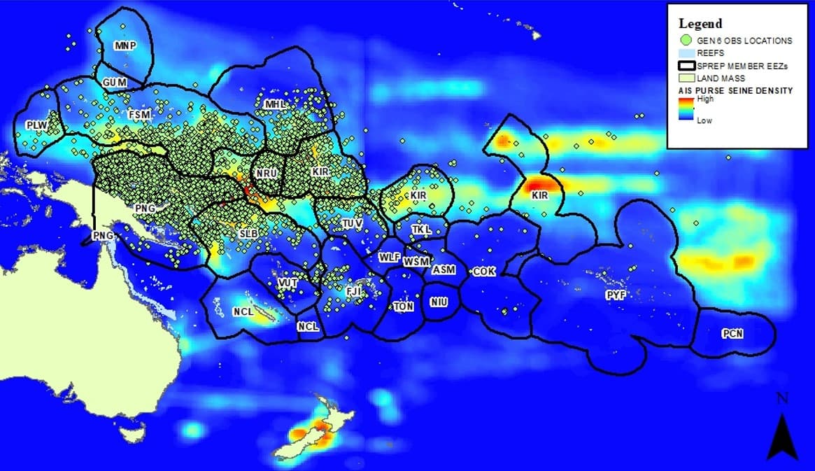 Coastal and Marine
Marine pollution originating from purse seine and longline fishing vessel operations in the Western and Central Pacific Ocean between 2003-2015 as derived from the Form GEN-6 , a tool to monitor fishing vessel violations. SPREP completed analysis of the marine pollution incidents reported by fisheries observers employed by the Secretariat of the Pacific Commission and Pacific Islands Foreign Fisheries Agency (SPC/FFA) as shown on the map.

This Dashboard gives an overview of all the help and support documents the Inform project has created. From manuals and video instructions, to license agreement templates, interesting presentations and software (and a lot more!). You can find all links to it here. Inform Docs All documentation for the SPREP Inform project in one place: general information on the project, Help material on the DKAN data portals and Help material for the Indicator Reporting Tool. Inform project training materials A collection of Inform project training materials, like PowerPoint presentations etc. You are free to download and change any of these training resources, to fit the purpose of your country training. Also check out the Training Action Plan! Inform e-learning course registration form Click on this link to register to the Inform e-learning course registration form. Data Portal Manuals Download the full data portal manual with all the essential info to get started. It includes FAQ's, Tips & Tricks, Good Practices and much more. Inform YouTube playlist Watch all the data portal instruction videos on the Inform YouTube playlist! The videos can also be downloaded here: https://pacific-data.sprep.org/dataset/video-instructions-data-portal State of the Environment Toolkit Download the SoE Guidelines or an SoE Template to get you started. Also check out SPREP's recommended template for environmental indicators and the icons to indicate status, trend and data confidence. SPREP core national environment indicators This list of indicators was developed through the Inform project at SPREP for use by Pacific Islands countries (PICs) to meet their national and international reporting obligations. The indicators have been designed to be measurable and repeatable so that countries can track key aspects of environmental health over time. Indicators can be used as is, adapted for countries needs, or used in conjunction with other national-scale indicators selected by PICs. This dataset includes a summary pdf document and an associated excel file with more detail: https://pacific-data.sprep.org/dataset/sprep-core-national-environment-i... Data Policy Templates This dataset contains templates of policies and MoU's on data sharing (Ministry Policy on Data Sharing, MoU Ministry to Ministry, MoU SPREP to Country). You can download the Word-templates and adapt the documents to your national context (see https://pacific-data.sprep.org/dataset/data-policy-templates ). Data for decision making workflow Workflow showing the different steps from data collection, processing, validation to upload to the data portal. Including links to indicator development, reporting, communication products and informed decision making. You are free to use this workflow to help explain and support data management and sharing. Data Portal License Agreements All license agreements for public, shared and private data can be found here: https://pacific-data.sprep.org/dataset/data-portal-license-agreements . These are templates for you to change according to your needs. Mobile Data Collection All info on Mobile Data Collection and KoboToolbox can be found here: https://pacific-data.sprep.org/dataset/kobotoolbox ACPMEA and Inform Joint Regional Meeting 2018 The ACPMEA and Inform projects held a Joint Regional Meeting at SPREP from 17-21 September 2018. All training and reference materials from this meeting can be found here: https://pacific-data.sprep.org/dataset/acpmea-and-inform-joint-regional-... . InforMEA Looking for more info on MEA's? Then consult "InforMEA", the United Nations Information Portal on Multilateral Environmental Agreements. https://pacific-data.sprep.org/dataset/informea-united-nations-informati... Excel pivot tables Watch this video to learn more on Excel pivot tables: https://pacific-data.sprep.org/dataset/excel-pivot-tables/resource/bcb80...
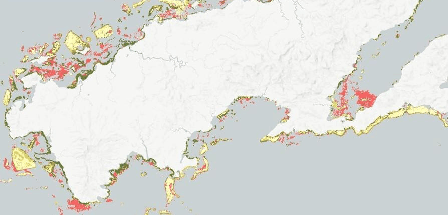
This Dashboard gives an overview of GIS related datasets on the Pacific Environment Portal. From digital atlases, interactive spatial data viewers to open access geospatial data repositories and online maps. You can find it all on this dashboard. PacGeo An open access geospatial data repository for the Pacific Region providing premier geophysical, geodetic, and marine spatial data sets. PacificMap The PacificMap provides easy access to spatial data: drag and drop your own spatial data on the map, or browse the Data Catalogue. OpenStreetMap Data Pacific OpenStreetMap data is available for 14 Pacific Island Countries, in a GIS-friendly format. The OSM data has been split into layers based on themes (buildings, roads, points of interest, etc), and comes bundled with a QGIS project to help you get started with using the data. For more details click above or search for the OSM dataset on your national Environment Data Portal. Allen Coral Atlas The Allen Coral Atlas aims to provide a high-resolution, up-to-date global image of the world’s coral reefs, and detailed maps showing the composition and structure of important reefs located throughout the world. Marine Atlas - Fiji, Tonga, Kiribati, Solomon Islands, Vanuatu The Marine Atlases for Fiji, Tonga, Kiribati, Solomon Islands and Vanuatu can be found on this portal. You can find both the reports and links to the Interactive data viewers. Search for the datasets using the keywords "Marine Atlas MACBIO". Protected Seas Open dataset of boundaries and regulations that apply to marine protected areas (MPAs) and fishery management areas in international marine waters. MGCP Topographic Dataset Freely available high-resolution topographic vector data for a selection of Pacific Island Countries. GEOSS Portal The GEOSS Portal is an online map-based user interface which allows users to discover and access Earth observation data and resources from different providers from all over the world. PCRAFI Pacific Catastrophe Risk Assessment and Financing Initiative. OpenDRI repository for the Pacific Region providing premier risk-related geospatial data sets. UN Biodiversity Lab The UN Biodiversity Lab is an online platform that allows policymakers and other partners to access global data layers, upload and manipulate their own datasets, and query multiple datasets to provide key information on the Aichi Biodiversity Targets and nature-based Sustainable Development Goals. Digital Atlas of Micronesia The Digital Atlas of Micronesia is the foremost source of maps and geospatial information for the Federated States of Micronesia. World Reef Map – Global Coral Reef Atlas Online interactive coral reef atlas that allows users to explore all of the coral reefs and shallow water marine habitats mapped on the Global Reef Expedition (Living Oceans Foundation). GOA-ON Global Ocean Acidification Observing Network data portal: this data portal contains platforms and products measuring ocean acidification parameters around the world. Mapping Ocean Wealth Explorer The Mapping Ocean Wealth data viewer is a live online resource for sharing understanding of the value of marine and coastal ecosystems to people. It includes global maps, regionally-specific studies, reference data, and a number of “apps” providing key data analytics. One example is the Mangrove Restoration Potential Map. Pacific Women in Geospatial Magazine A magazine by women active in the geospatial industry to promote the profession to girls in school. PIPAP QGIS Training If you want to learn GIS skills to help you map protected areas, these 3 video's are for you. This collection of videos is an introductory, basic-level training to open source GIS software (QGIS) targeting technical-level government officers. QGIS Want to create a map, open a GIS file or do spatial analysis? QGIS is a Free and Open Source Geographic Information System that allows you to do that. The Pacific Environment Portal shows you how to get started: https://pacific-data.sprep.org/dataset/qgis